Unsettled but mild is the theme.
Thanks again to Tracy for the photograph.
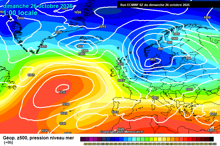
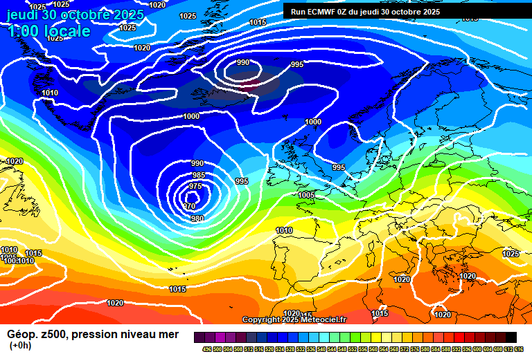
The general set-up sees low pressure to the west taking control – it’s going to head towards Iceland but it will keep sending weather fronts our way.
Thursday starts bright with some sunny spells. Cloud will thicken from the west this morning, the first weather front will cross this afternoon but little in the way of rain, occasional patchy light rain at most – it may even stay dry with some bright spells. Around 13’C. The weather front arrives around late evening and will bring a few hours of showery rain, some heavy bursts possible. Still around 13’C and quite windy.
Friday is a mostly cloudy start to the day. Some showery rain will spread up from the south-west during the morning, heavy bursts possible. Some bright spells probable in the afternoon but further showers probable too, heavy, perhaps very heavy with a rumble of thunder. Generally a windy day, gusty in showers, but also milder – around 16’C. Further heavy, showery rain arriving mid/late evening, perhaps very heavy at times – again some strong gusts of wind possible. Drier towards dawn, though a shower still possible in the wind, around 11’C.
Saturday looks like a mixture of sunny spells and scattered showers, showers more likely lunchtime onwards, possibly heavy/very heavy with a rumble of thunder, though some uncertainty on how many develop – potentially your area could stay dry. Around 13’C, maybe 14’C and breezy – especially in the morning. Further heavy showers at time in the evening and overnight, and some cooler air in the mix again – down to around 7’C.
Sunday should actually be a reasonable day, perhaps still some cloud/showers first thing but mostly dry with sunny spells and variable cloud after that clears. Around 12’C and breezy. Cloudy overnight with some patchy rain at times – though the bulk will be further north.
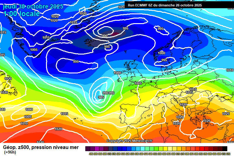
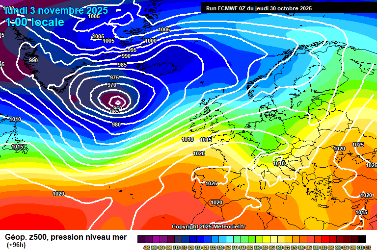
By Monday the low pressure system is still towards Iceland, now re-enforced by ex-Melissa, which adds a bit more tropical energy but also potentially some more tropical air for us in a day or two.
Generally Monday will be a cloudy day, with some bits of showery rain but not much, and windy. Milder at around 15’C or so. Similar conditions overnight, no lower than around 12’C.
Tuesday looks broadly cloudy and windy as a weather front decays over us – perhaps some rain but quite uncertain on that. Milder, around 16’C.
Wednesday is uncertainty – broadly cloudy and windy would seem a reasonable bet for now, we might have some more tropical air over us so anything up to 18’C is feasible, though it could easily be 14’C which is mild but pretty ordinary.
High pressure building over Europe, which I’d suggest may be due to ex-Melissa, should keep weather fronts at bay to an extent after that – I think one or two will still get through, but generally more dry weather. And milder than normal seems likely.
Have a pleasant end to the week.…