Some sunshine, some cloud and generally staying very warm.
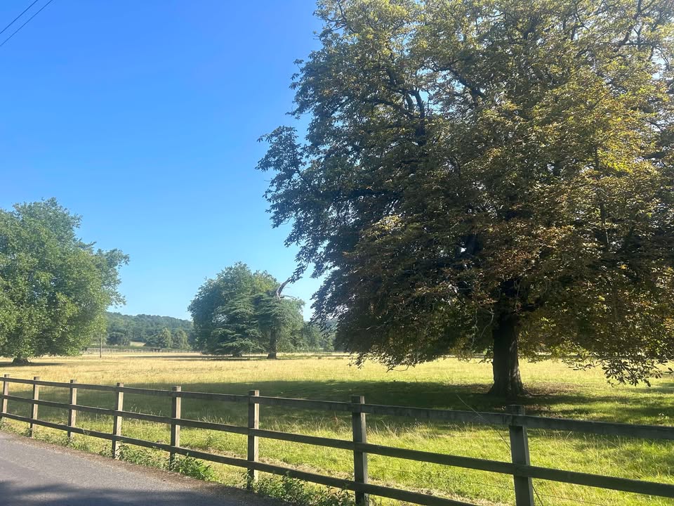
Thanks to Karen for the photograph.
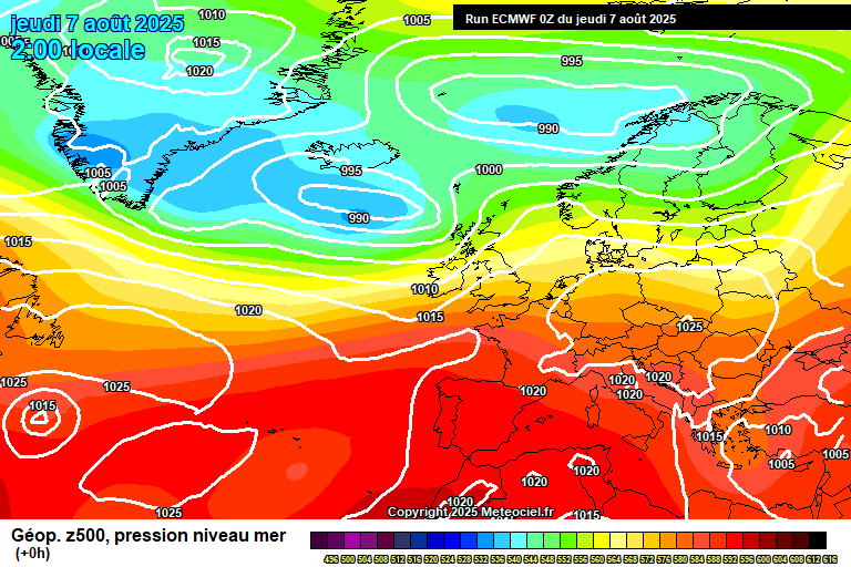
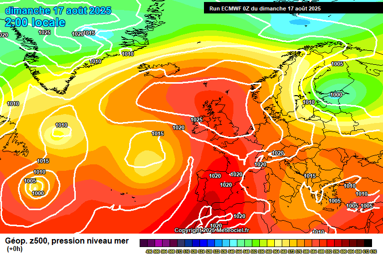
The general picture sees high pressure in control, centred over Scotland which means an easterly flow which means temperatures not quite as hot as they could be – which also caused all that cloud yesterday, which hung around a lot longer than expected.
What cloud there was has already cleared this morning, and we’ll be left with a mostly sunny day – some cloud is possible at times, though sunshine will dominate. Warm, around 24’C. The cloud spilling back across from the North Sea overnight, no lower than around 16’C.
Monday morning looks cloudy. The sun will break through at some point in the afternoon, maybe early afternoon, arguably more likely by mid/late afternoon, to leave a pleasant end to the day. Temperatures will depend on how quick the sun comes out, somewhere between 21’C and 25’C. Cloud gradually thickening overnight, though somewhat more haphazardly than the previous night, down to around 15’C.
Tuesday starts rather cloudy, though some sunny breaks will be possible. And the day generally continues like this – most likely more cloud than sunshine, though some uncertainty on cloud amounts overall. A very small chance of a shower later in the day. Temperatures reaching somewhere between 22’C and 25’C, depending on how much sunshine we see. Mostly cloudy overnight, a chance of a spot of light rain, down to around 14’C.
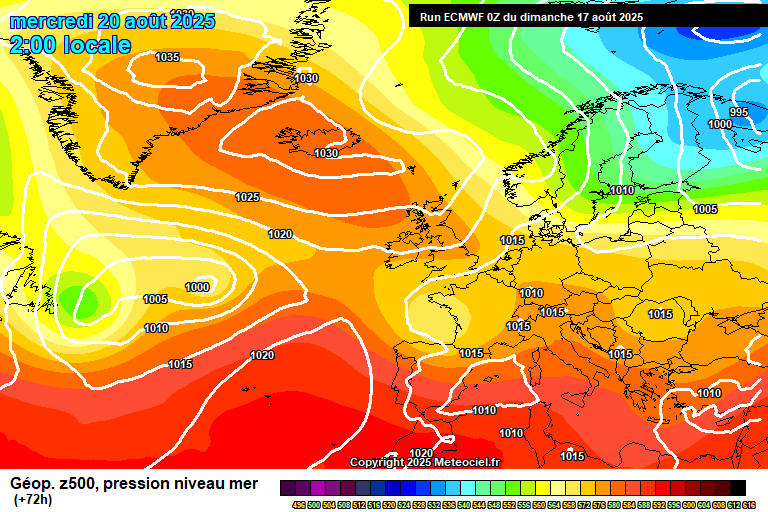
By Wednesday high pressure is more centred over Iceland, and we have some kind of north-easterly flow.
Probably mostly cloudy in the morning, the chances of some sunny spells will increase in the afternoon. A bit of a fresher feel, but still reaching close to 22’C. Some cloud, some clear spells overnight, down to around 14’C.
Thursday will more likely see a fair amount of cloud again, cloud more likely in the morning, sunny spells more likely in the afternoon – though details by this point become more uncertain, as per usual. Around 21’C or so. Clear spells more likely overnight than cloud, down to around 10’C so cooler than of late.
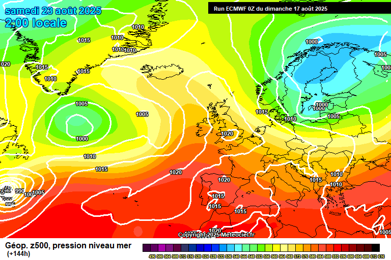
Friday sees high pressure taking over once more, though a hint of a northerly flow so temperatures again not quite what they could be. So more in the way of sunshine (probably)! and temperatures roughly around 22’C.
Somewhat uncertain for the bank holiday weekend, as there will be a major hurricane (Hurricane Erin) in the Atlantic, off the coast of USA, though at the moment it looks like it will help push high pressure our way, at least for Saturday.
So Saturday probably looks reasonably sunny and very warm – though I wouldn’t want to promise that right now, say 70% confidence.
For Sunday and Monday it is more uncertain, and will depend on how Hurricane Erin interacts with the low pressure to the west of us – some models suggest it subsumes it and hence slows down the progress of low pressure systems towards us – the result being that we import some heat from our south, so becoming hot and sunny.
But it could also split and push the original low pressure, which would mean some rain/showers for Sunday/Monday, but I stress the word “some”. I currently think the former more likely, but low confidence.
Current suggestions are that the remnants of Erin will introduce a more unsettled week to finish August, though this is a long way away – and highly uncertain.
Have a good Sunday, I shall be back on Thursday morning.…